Shapefile manipulation of WKT from READ FROM KML Node
I use knime 4.7.8 for the last existing knime kml reader. I have separate more recent versions once I step outside of working with shapefiles.
The system provides the standard WKT format “-105.0125339 39.5484934,” etc. I’m used to this format and it’s what google maps provides from my hand-drawn polygons.
But I have a potential service provider I wish to copy and paste into their system (no automatic upload available from provider), but they require a shapefile format I have never seen (Claude AI doesn’t recognize it either) “40.361365685459035+ -74.6660900115967,” etc.
Please see attached graphic below. Upper portion is their requirements; bottom section is what I currently have.
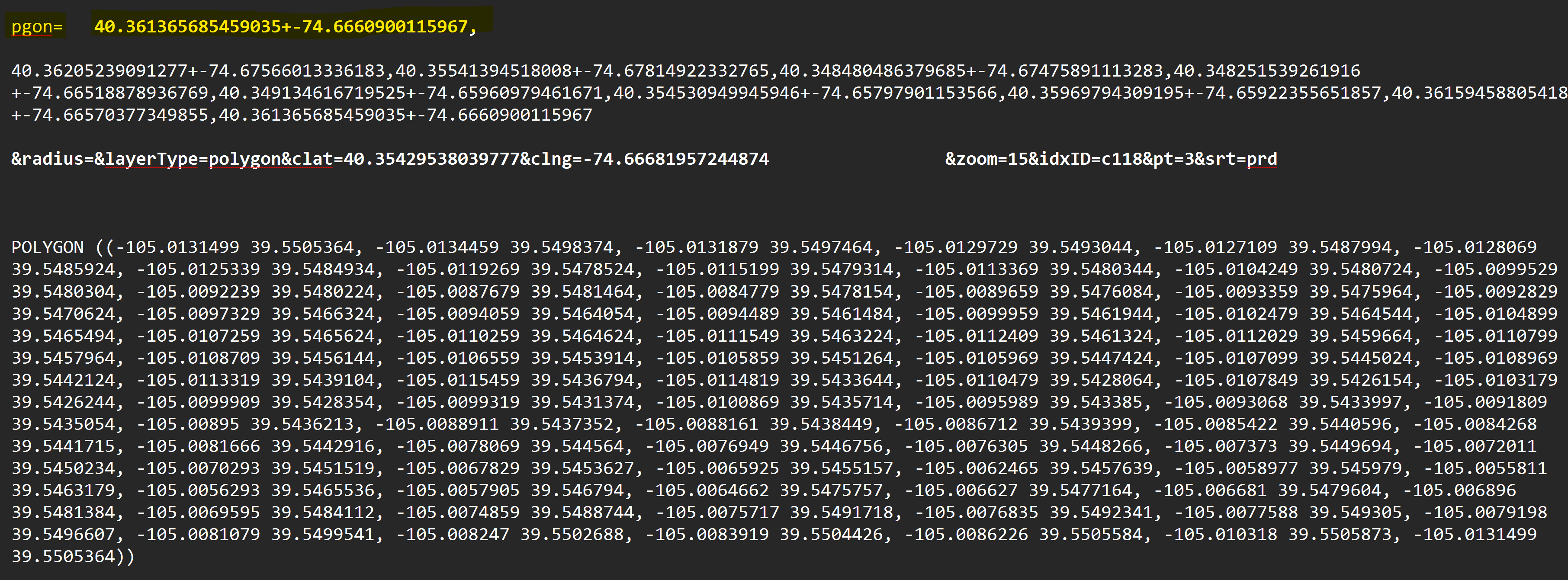
It seems they flipped the lat/long points for each point in the shapefile. I don’t know how I can flip the points in knime. And they smashed in a “+” instead of leaving a space. Any ideas or specific nodes you can think of that will reformat lat/long points to their desired format?
Thanks